
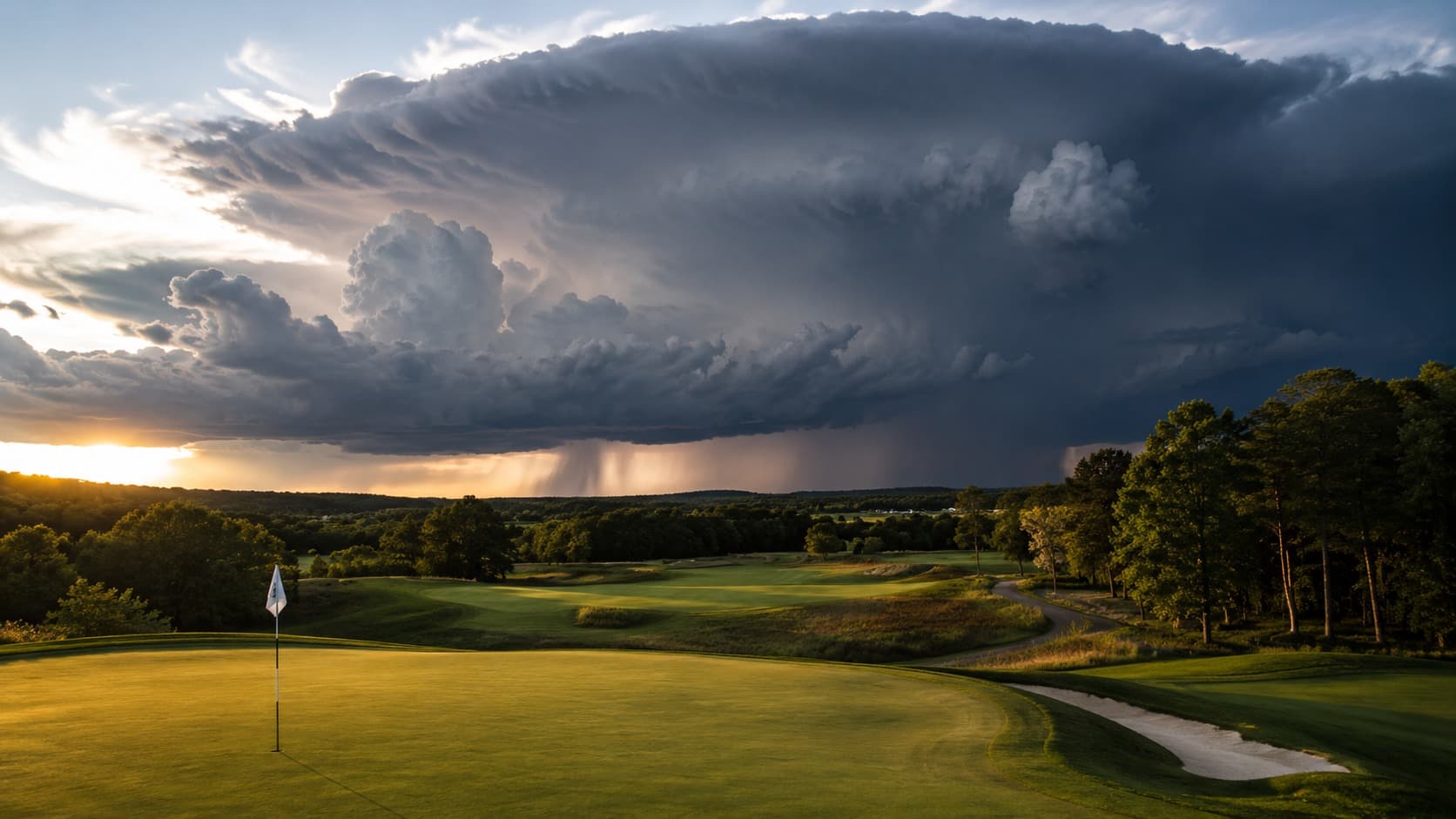
The scoreboard that day said I shot 41 on the front nine at a course in central Florida and never finished the back. What it did not say was that I spent the last forty minutes of that round in a maintenance shed with eleven strangers, listening to a lightning strike hit close enough that the concrete floor buzzed. The sky at 8am had been a flawless blue. The first tower of cumulus appeared over the tree line around 12:30pm. By 2:45pm the course was under a severe thunderstorm warning and the round was over. I had checked the forecast that morning. It said 40% chance of afternoon thunderstorms. I read that as “probably fine” and teed off anyway.
That 40% number is one of the most misread figures in golf. It does not mean there is a 40% chance your round gets rained on evenly across the day. In the summer convective season it means something much more specific and much more actionable: the morning will almost certainly be clear, and the afternoon carries a meaningful risk of a fast-building, high-energy storm that can go from first cloud to lightning in under two hours. The storm is not random. It is the predictable output of a daily heating cycle, and once you understand that cycle you stop getting caught in the shed.
This post is the meteorology of the summer afternoon thunderstorm, the G-Score data on how the storm cycle punishes afternoon tee times across the Southeast, Midwest, and desert Southwest, the lightning-safety decision tree that actually matters, and the planning workflow that lets you play a full summer round and be in the clubhouse before the first bolt. If you play golf between June and September anywhere east of the Rockies or in the monsoon zone, this is the variable that most often decides whether you finish.
What a Summer Afternoon Storm Actually Is
Most summer thunderstorms east of the Rockies are airmass storms — storms that form not from a passing front but from the daily heating of a warm, humid airmass sitting in place. The mechanism is simple and it repeats almost every summer day the airmass is unstable. Overnight and into the morning, the atmosphere is relatively stable. The sun heats the ground through the morning. Warm, moist air near the surface becomes buoyant and starts to rise. As it rises it cools, the water vapor condenses into cumulus clouds, and the condensation releases heat that makes the air parcel even more buoyant, driving it higher. Given enough surface heating and enough low-level moisture, that rising column builds into a full thunderstorm by early-to-mid afternoon.
Meteorologists measure the fuel for this process as CAPE — convective available potential energy. High CAPE plus a trigger (the afternoon heating peak, a sea breeze, a terrain feature) equals afternoon storms. The critical point for golfers is the timing: because the process is driven by the daily heating cycle, airmass storms have a strong diurnal rhythm. They are rare before late morning, they build through the early afternoon, they peak between roughly 2pm and 6pm, and they weaken after sunset as the heating source disappears. This is why a 40% daily storm chance in July is really a near-zero chance at 8am and a much higher chance at 4pm, averaged into a single misleading number.
The published meteorological consensus on this is not controversial. National Weather Service forecast discussions across the Southeast describe the pattern in nearly identical language every summer: stable mornings, destabilizing afternoons, scattered to numerous convection developing after peak heating, diminishing after sunset. The daily storm is a feature of the summer airmass, not an accident of it.
The G-Score Data: How the Storm Cycle Punishes the Afternoon
We pulled the hourly G-Score profile across a sample of summer monitored rounds in the high-convection regions to see how the storm cycle shows up in the playability data. The shape is the mirror image of the calm-morning pattern: a high, stable G-Score through the morning, then a sharp afternoon collapse on active days.
At TPC Sawgrass in July, the average 8am G-Score sits at 76, held down mainly by heat and humidity rather than storms. By 1pm it has dropped to 69. On days flagged as convectively active, the 3pm to 5pm G-Score collapses into the 40s and 30s before the round is suspended entirely — the storm variable overwhelms every other input. The morning-to-storm-afternoon swing on an active day is the single largest same-day playability drop we track, larger even than the coastal wind swings we cover in the morning versus afternoon analysis.
Across the Southeast the pattern holds with regional timing shifts. At Harbour Town and the Kiawah Island Ocean Course, the coastal sea breeze acts as an additional trigger, and storms can fire slightly earlier and more reliably along the immediate coast than a few miles inland. At Quail Hollow in the Carolina Piedmont and East Lake in Atlanta, the storms tend to build a little later, with the peak risk window from 3pm to 7pm as the inland airmass takes longer to destabilize.
The Midwest runs a similar but often more organized cycle. At Whistling Straits on the Lake Michigan shore, the lake breeze can suppress storms right at the water’s edge while firing them just inland, producing a sharp gradient where the course itself may stay dry while the range twenty minutes away floods. Midwest summer storms are also more likely than Southeast airmass storms to be frontal and organized, which changes the safety math — more on that below.
The desert Southwest has its own version. During the North American Monsoon from roughly July through mid-September, moisture surges into Arizona and produces afternoon and evening storms that are less frequent than Florida’s but often more violent, with dangerous lightning, microburst winds, and dust. At TPC Scottsdale, the summer G-Score is already suppressed by extreme heat, and the monsoon storm risk stacks a second afternoon hazard on top of it. The desert monsoon storm is the reason summer desert golf is almost entirely a dawn-and-twilight game.
The cross-region takeaway is consistent: in the summer convection zone, a morning tee time is not a preference, it is a risk-management decision. The G-Score data shows the morning window is not only more comfortable but structurally safer, because it sits before the daily storm cycle switches on.
Why Storm Timing Matters for Score, Not Just Safety
Lightning is the headline hazard, and we will get to the safety decision tree. But the storm cycle affects your score long before any bolt appears, and understanding the pre-storm and post-storm phases is part of playing summer golf well.
The pre-storm phase is deceptively difficult. In the hour or two before an airmass storm fires, the air is at its most humid and unstable. Outflow from distant storms can produce erratic, shifting gusts on an otherwise calm-looking day. The heat index is often at its daily peak. Your body is at its most fatigued, which is exactly the fatigue-and-decision problem covered in the summer survival guide. Many golfers post their worst scores of the day in this pre-storm window without ever realizing a storm was building the whole time.
The post-storm phase, if the storm passes and you are able to resume, is a genuinely different golf course. Greens that were firm and fast in the morning become soft and receptive. Fairways hold water and give zero roll, so a drive that ran out to 285 yards in the morning stops at 255 in the afternoon. Bunkers may be saturated. The rain-probability analysis walks through how the G-Score models the scoring penalty of wet conditions, and the practical adjustment is real: club up on approaches into soft greens, expect no roll off the tee, and re-read every putt because green speed drops sharply after a soaking.
The Lightning Safety Decision Tree
This is the part that is not optional. Lightning is the deadliest weather hazard in golf, and golf courses are among the most dangerous places to be during a storm: open terrain, isolated tall trees, metal clubs, and elevated positions. The safety logic is simple and you should treat it as non-negotiable.
- The 30-30 rule. If the time between a lightning flash and its thunder is 30 seconds or less, the storm is within about six miles — close enough to strike your location next. Stop play and seek shelter immediately. Do not resume until 30 minutes have passed after the last thunder. Storms move fast and the strike range extends well beyond the visible rain.
- Do not wait for the rain. Lightning routinely strikes 10 miles or more from the storm core, well ahead of any rainfall — the so-called bolt from the blue. If you can hear thunder, you are already within strike range. The rule is simple: when thunder roars, go indoors.
- Seek real shelter. A fully enclosed building or a hard-topped metal vehicle with the windows up. Not a shelter hut, not a tree, not a golf cart, not an umbrella. Open-sided rain shelters on courses are notoriously dangerous in lightning and have been the site of fatal strikes.
- If caught in the open with no shelter, get to the lowest point available, put down your clubs and umbrella, and minimize your contact with the ground. Do not lie flat. The goal is to be neither the tallest object nor spread across a large area of ground.
- Trust the horn and the app. Most managed courses sound a horn to suspend play. Do not second-guess it to finish a hole. Our G-Score alerts can push a storm warning to your phone the night before and the morning of, so the decision to shorten or reschedule a round is made before you tee off, not while you are standing on the 14th fairway watching a wall cloud build.
The Two Storm Patterns You Should Recognize
Pattern 1: The Pop-Up Airmass Storm (the Textbook Summer Day)
Morning is clear and calm. Fair-weather cumulus appears by late morning and grows taller through early afternoon. Individual storm cells fire, drift slowly, and rain out over 30 to 60 minutes each. Coverage is scattered, so one course gets soaked while another five miles away stays dry. Timing is the reliable part: the risk is near zero before 11am and climbs steadily to a mid-to-late-afternoon peak.
Planning logic: this is the most manageable storm day if you tee off early. A 7am to 8am tee time finishing by noon usually beats the cycle entirely. The G-Score profile is a clean descending curve, high through the morning and collapsing into the afternoon on any given cell’s path. Recognize it the night before when the forecast pairs a high heat index with “scattered afternoon thunderstorms” and no mention of an approaching front.
Pattern 2: The Organized Frontal Storm (the Different Animal)
When a cold front or a strong upper-level disturbance is involved, the storms are no longer tied to the afternoon heating peak. They can arrive at any hour, including early morning, and they often come as a fast-moving line rather than isolated cells. These storms are more likely to produce damaging wind, hail, and continuous lightning, and they do not respect the tidy afternoon timing of airmass storms.
Planning logic: the morning-tee-time strategy does not protect you here, because a frontal line can roll through at 9am. The right move on a frontal day is to watch the timing of the front specifically — not the generic daily storm chance — and to be willing to reschedule. Recognize it the night before when the forecast mentions “a cold front,” “a line of storms,” or storm chances that are high across the entire day rather than concentrated in the afternoon.
The Summer Storm-Season Workflow
If you are playing in the convection zone between June and September, this is the workflow:
- Book the earliest tee time you can tolerate. The morning window is before the daily storm cycle switches on. This is the same conclusion the morning versus afternoon data reaches for wind, and it is doubly true for summer storms.
- Read the hourly forecast, not the daily percentage. A 40% daily chance concentrated between 3pm and 7pm is a green light for an 8am round and a red light for a 2pm round. The single daily number hides the entire decision. The G-Score tutorial explains how the hourly playability profile turns that vague percentage into a tee-time decision.
- Distinguish airmass from frontal. If the forecast mentions a front or a line of storms, the morning is not automatically safe and you should watch the specific timing of the system. If it is a generic “scattered afternoon storms” day, the early tee time is your protection.
- Pre-commit to a turnaround trigger. Decide before the round what you will do when you hear the first thunder or the horn sounds. The answer is always the same: stop and shelter. Deciding in advance removes the temptation to finish one more hole.
- Watch the sky on the back nine. A rapidly building tower of cumulus with a hard, cauliflower top is a storm in progress. A darkening base and the first distant rumble are your cue to head in. Do not wait for the rain — by the time it rains, the lightning risk has already been present for a while.
What Trip Planning Looks Like in Storm Season
If you are planning a summer golf trip to a high-convection destination, the storm cycle should shape the whole itinerary, not just a single tee time. Florida is the summer lightning capital of the country, and its summer G-Score rankings are defined almost entirely by the afternoon storm cycle from June through September — the mornings are playable and the afternoons are a coin flip. Georgia, the Carolinas, and the Gulf Coast run similar patterns.
For a multi-day summer trip, the logic is: play every round in the morning, schedule your most exposed or most important course on the day with the lowest frontal risk, and keep the afternoons free for the pool rather than the first tee. In the desert, the calculus is even more extreme — Arizona summer golf as reflected in the desert rankings is a dawn-and-twilight game, with the monsoon adding an afternoon storm hazard on top of the heat. In Texas, the Texas rankings show the same morning-first pattern across a state large enough to have several distinct storm regimes at once.
The weekly best ranking is the tool for this: it surfaces the highest-G-Score windows in the coming seven days, which in summer means it is effectively finding the mornings and the post-frontal clear days when the storm cycle is briefly switched off.
Bottom Line
The summer afternoon thunderstorm is the most predictable dangerous weather in golf. It is not random. It is the daily output of a heating cycle that makes the morning safe and the afternoon a gamble across most of the country east of the Rockies and in the monsoon Southwest. Read the hourly forecast instead of the daily percentage. Book the early tee time. Learn to tell an airmass day from a frontal day. And when you hear thunder, go in — no hole is worth the shed.
The round I never finished in central Florida was entirely avoidable. The 40% chance was not a mystery; it was a schedule I did not know how to read. I have played hundreds of summer rounds since and finished almost all of them, not because I got lucky with the weather but because I stopped teeing off into the teeth of the daily cycle. If you want the hourly G-Score profile for your next summer round, the course dashboard shows the full daily curve in one screen, the alerts system flags the storm days for any course you save, and the rain guide breaks down how wet-weather variables feed the score. The storm is coming this afternoon. The only question is whether you will be on the 18th green or in the parking lot when it arrives.